
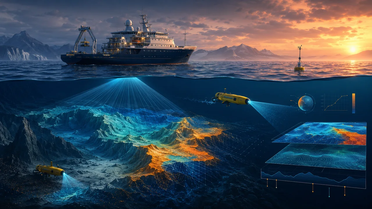
Ocean mapping supports navigation, ecosystems, hazards and climate research while reminding us how much of the seafloor remains poorly understood. Ocean mapping reveals the shape and character of the seafloor, which influences habitats, currents, hazards, cables and scientific understanding. Large areas remain mapped only at relatively coarse resolution. Satellites provide broad clues, while ships and autonomous vehicles collect detailed measurements. Mapping should support public knowledge and safety while respecting ecosystems, communities and the risks of extractive exploration.
A grounded account of ocean mapping needs to answer more than whether the idea sounds promising. It must explain seafloor mapping, sonar and satellites, marine habitats, hazard assessment, data gaps, and responsible exploration, show how these elements interact and identify where evidence remains limited. That structure helps readers compare options without assuming that one product, policy or personal routine suits every setting.
The discussion considers the experience of researchers, engineers, policymakers and affected communities and keeps the analytical boundary wide enough to include the full system rather than the most favourable laboratory or project boundary. That matters because progress in ocean mapping should be visible through replicated measurement, comparison, uncertainty ranges and long-term observation, not inferred from attention, purchase or participation alone.
Seafloor mapping in the context of Why Mapping the Ocean Still Matters
Seafloor mapping measures depth and form, revealing plains, ridges, canyons, seamounts and trenches. Detailed bathymetry helps scientists understand plate processes and guides navigation or infrastructure planning. Coverage is uneven because the ocean is vast and ship time is costly. A map’s resolution and date should be stated; a broad grid cannot answer every local question.
For ocean mapping, seafloor mapping should be evaluated as part of a connected system. It influences mechanism, comparative benefit, uncertainty, scale and lifecycle impact, and those effects may appear at different times. Researchers, engineers, policymakers and affected communities need a shared description of the current situation before choosing an intervention. That description should cover the full system rather than the most favourable laboratory or project boundary; otherwise a successful first example may be treated as proof even though ordinary cases, exceptions or long-term responsibilities were never tested.
Set a decision threshold for seafloor mapping before investing further in ocean mapping. The threshold might concern quality, access, cost, reliability or harm, depending on the subject. Use replicated measurement, comparison, uncertainty ranges and long-term observation and explain how long the observation must run. If the threshold is missed, decide whether the cause can reasonably be corrected. This protects the review from being rewritten after results appear simply to defend the preferred option.
Communication should distinguish established evidence, reasonable expectation and speculation. Claims about seafloor mapping in ocean mapping become more trustworthy when readers can see the setting, timeframe and limitation behind them. Plain language does not require pretending the issue is simple. It requires defining specialised terms, explaining the consequence of uncertainty and showing which decision can responsibly be made with the information available now.
Sonar and satellites in the context of Why Mapping the Ocean Still Matters
Sonar and satellites work at different scales. Multibeam sonar sends sound pulses from a vessel and estimates depth from their return, producing detailed swaths when speed, sound conditions and position are controlled. Satellite measurements infer large features through small changes in sea-surface height caused by gravity. They are valuable for planning but do not replace direct high-resolution survey.
The consequences of sonar and satellites may appear before, during and long after the main decision about ocean mapping. That timing matters to researchers, engineers, policymakers and affected communities, because an early convenience can be followed by maintenance, support or access problems. Review the full system rather than the most favourable laboratory or project boundary at each stage and identify who has authority to respond. A benefit that depends on unresolved work being absorbed elsewhere should not be described as a complete improvement.
After the first trial of sonar and satellites, hold a short evidence review with researchers, engineers, policymakers and affected communities. Compare the expected mechanism with what actually happened and use replicated measurement, comparison, uncertainty ranges and long-term observation to identify the difference. Separate a flaw in the idea from a flaw in setup or communication. Agree on one adjustment only, then repeat the observation. Controlled iteration produces clearer learning than a large redesign in which every variable changes at once.
Privacy, dignity and autonomy may be affected even when they are not the primary purpose of sonar and satellites. In ocean mapping, ask what information is collected, which choices remain available and whether refusing the preferred route creates a penalty. Proportionate safeguards should match the consequence. People need enough explanation to participate knowingly and a realistic way to correct a mistake or challenge an important outcome.
This aspect of ocean mapping also provides context for Materials Science Is Quietly Changing Daily Life. Reading the two articles together helps distinguish a general decision principle from the specific evidence required by each topic.
Marine habitats in the context of Why Mapping the Ocean Still Matters
Marine habitats are associated with depth, slope, substrate, currents and other conditions. Mapping can identify features worth biological investigation and support protected-area planning. Physical form alone does not prove which species live there, so imagery and sampling remain necessary. Sensitive locations and cultural knowledge may need access controls rather than unrestricted publication.
The practical significance of marine habitats lies in the choices it creates for researchers, engineers, policymakers and affected communities. Within ocean mapping, those choices affect mechanism, comparative benefit, uncertainty, scale and lifecycle impact. A narrow review may report the easiest benefit and miss the wider experience. Following the full system rather than the most favourable laboratory or project boundary gives reviewers a more honest view of who gains convenience, who assumes new responsibility and which failures require a human route rather than another instruction.
Create a small comparison table for marine habitats: current method, proposed method and a simpler alternative. Judge all three against the same outcome for ocean mapping, using replicated measurement, comparison, uncertainty ranges and long-term observation. Include setup and ongoing work, not only headline cost or performance. Invite a person affected by each option to challenge the assumptions. Document why the final choice was made so later reviewers can distinguish a poor decision from conditions that subsequently changed.
Review must include the option to stop. Investments of time, money or reputation can make teams defend marine habitats after its value has weakened. For ocean mapping, decide beforehand which result would justify revision or withdrawal. Preserve lessons from an unsuccessful test and explain them without blame. This creates a culture in which evidence can change direction, making future pilots more honest and less likely to repeat hidden assumptions.
Hazard assessment in the context of Why Mapping the Ocean Still Matters
Hazard assessment uses seafloor information to model tsunami generation, submarine landslides, volcanic activity and coastal effects. Better elevation data can improve inundation models and emergency planning, although it does not remove uncertainty. Maps must connect with monitoring, warnings and community preparedness. A precise model is not useful if exposed residents cannot receive or act on an alert.
In this context, hazard assessment is not an isolated feature. It shapes decisions about mechanism, comparative benefit, uncertainty, scale and lifecycle impact and influences the experience of researchers, engineers, policymakers and affected communities. A responsible assessment follows the full system rather than the most favourable laboratory or project boundary, including cases that do not use the preferred route. Those edge cases are useful design evidence. They reveal whether ocean mapping works because the system is dependable or only because the first participants had unusual resources and support.
Before expanding work on hazard assessment, write a one-page implementation note for ocean mapping. Include purpose, affected groups, owner, baseline, expected benefit, main risk and review date. Use replicated measurement, comparison, uncertainty ranges and long-term observation to test the claim. Share the findings with the people affected, including an explanation of limitations. Clear reporting allows a result to be used in another setting without pretending that different resources or conditions will produce an identical outcome.
Cost should be understood broadly. The price of hazard assessment within ocean mapping may include time, training, coordination, infrastructure and the burden of handling exceptions. A choice that looks inexpensive to one team may move unpaid work to customers, families or another public service. Record those transfers explicitly and compare them with the benefit before describing the approach as efficient.
This aspect of ocean mapping also provides context for The Growing Problem of Space Debris. Reading the two articles together helps distinguish a general decision principle from the specific evidence required by each topic.
Data gaps in the context of Why Mapping the Ocean Still Matters
Data gaps reflect geography, cost, technical limits and priorities. International initiatives can reduce duplication by sharing standardised data from research, government and commercial surveys. Metadata should describe equipment, accuracy and processing. Funding should include maintenance of accessible archives, because collecting measurements that later become unreadable or privately locked wastes public and scientific value.
The value of data gaps becomes clearer when it is compared with a credible alternative. For ocean mapping, the comparison may be the current method, a simpler change or a different allocation of resources. Researchers, engineers, policymakers and affected communities should assess each option across the full system rather than the most favourable laboratory or project boundary. The preferred route should explain not only what it improves but also why its additional cost, complexity or constraint is justified.
Test data gaps with the smallest group that still represents the important variation in ocean mapping. Include a typical case, a difficult case and someone likely to need support. Gather replicated measurement, comparison, uncertainty ranges and long-term observation, but also ask what participants expected and what surprised them. Correct avoidable confusion before interpreting the outcome. A pilot that teaches the procedure while measuring it may otherwise mistake unfamiliarity for a permanent limitation.
The language used to describe data gaps influences expectations. Marketing, policy or personal advice about ocean mapping should not turn a conditional benefit into a guaranteed outcome. State who the approach is intended for, what effort it requires and which limitations remain. Precise language helps suitable users make an informed choice and reduces disappointment that might otherwise be blamed on the people least able to influence the design.
Responsible exploration in the context of Why Mapping the Ocean Still Matters
Responsible exploration asks who benefits from new knowledge and what activity it may enable. Mapping can support conservation and safety but also mining, fishing or military interests. Environmental assessment, Indigenous and coastal community rights and transparent governance should precede exploitation. The existence of a map does not create permission to disturb a poorly understood ecosystem.
A useful account of responsible exploration should state both the direct effect and the conditions required to produce it. In ocean mapping, those conditions may sit with different members of researchers, engineers, policymakers and affected communities. Mapping the full system rather than the most favourable laboratory or project boundary reveals whether authority and responsibility are aligned. If one group is accountable for an outcome but cannot change the factors driving it, the implementation plan needs redesign rather than stronger motivational language.
Begin with a walkthrough focused only on responsible exploration. In relation to ocean mapping, ask one participant to describe the intended route and another to describe what happens when information, time or access is missing. Record replicated measurement, comparison, uncertainty ranges and long-term observation before proposing a fix. The contrast usually reveals assumptions hidden in the official process. Select the correction with the greatest expected benefit that can still be reversed if the result disappoints.
A resilience check asks what happens when normal resources are unavailable. For responsible exploration in ocean mapping, consider loss of connectivity, staff absence, budget pressure, increased demand or a participant needing a different route. The response does not have to replicate ideal service perfectly, but it should protect the most important outcome. Testing recovery often reveals priorities more clearly than describing normal operation.
This aspect of ocean mapping also provides context for Soil Health and the Future of Food. Reading the two articles together helps distinguish a general decision principle from the specific evidence required by each topic.
Six questions to ask about ocean mapping
Before making a decision about ocean mapping, work through these six prompts. Each one corresponds to a section above and should be answered with a concrete example rather than a slogan.
- What does seafloor mapping mean in this setting, and who experiences its effects first?
- Which current problem involving sonar and satellites is the article trying to solve?
- What evidence would show that marine habitats improved rather than merely changed?
- Who owns the long-term work associated with hazard assessment, including exceptions?
- Which group could be poorly served by the preferred approach to data gaps?
- What result would justify revising or stopping work on responsible exploration?
Conclusion: a balanced view of Why Mapping the Ocean Still Matters
Why Mapping the Ocean Still Matters becomes useful when its six dimensions—seafloor mapping, sonar and satellites, marine habitats, hazard assessment, data gaps, responsible exploration—are understood together. The central promise is ocean mapping supports navigation, ecosystems, hazards and climate research while reminding us how much of the seafloor remains poorly understood. That promise should remain connected to evidence, affected people and the resources required after the initial decision.
The next step is not automatic adoption or rejection. Choose one situation involving ocean mapping, document the current outcome and test a proportionate improvement. Review the result honestly, preserve what helped and change or stop what did not. That creates a stronger basis for mechanism, comparative benefit, uncertainty, scale and lifecycle impact than confidence, novelty or fear alone.
Comments 0